
ACF OpenStreetMap Field Wordpress Plugin - Rating, Reviews, Demo & Download

Plugin Description
Hazzle free OpenStreetMap with ACF.
Usage
In the Fieldgroup editor:
Return Format:
-
Raw data will return an array holding the field configuration.
-
Leaflet JS will return a fully functional leaflet map. Just include
<?php the_field('my_field_name'); ?>in your Theme.
You can choose from a long list of map styles and it supports multiple markers. -
iFrame (OpenStreetMap.org) Will return an iFrame HTML. Only four map styles are supported
– the ones you find on OpenStreetMap – and not more than one marker.
Map Appearance: Pan and zoom on the map and select from the Map layers to set the initial map position and style in the editor.
Map Position: If you’re more like a numbers person here you can enter numeric values for the map position.
Allow layer selection: Allow the editors to select which map layers to show up in the frontend.
Height: Map height in the frontend and editor.
Max. number of Markers
– No value: infinite markers
– 0: No markers
– Any other value: Maximum number of markers. If the return format is iFrame there can ony be one marker.
Map Proxy
The plugin comes with a proxy mechanism for map tiles. If enabled the Browser will load the tiles from your server rather than directly from the tile provider.
Use the proxy to hide sensitive credentials from the users out there or if you have to comply with local privacy regulations. the European GDPR.
Development
Please head over to the source code on Github.
Credits
- ACF for sure!
- The OpenStreetMap project
- The Leaflet Project
- The maintainers and contributors of Leaflet providers
- The very same for Leaflet Control Geocode
- Dominik Moritz who delighted us with Leaflet locate control
- Numerous individuals and organizations who provide wonderful Map related services free of charge. (You are credited in the map, I hope)
- The proxy feature was inspired by an article by Klaus Meffert, Dr. DSGVO Blog, Link (German)
Screenshots
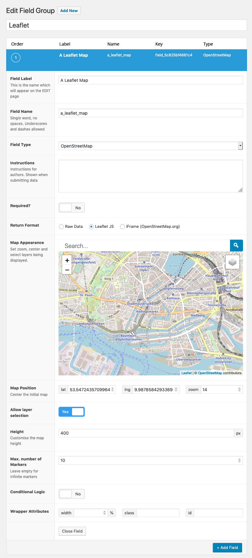
ACF Field Group Editor
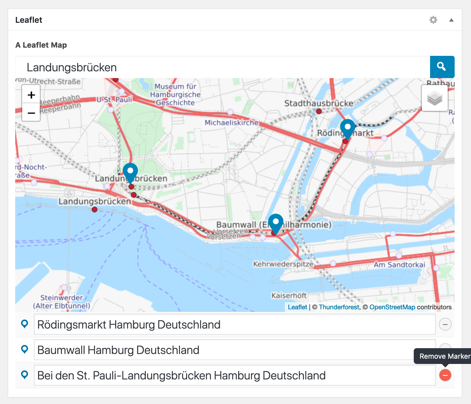
Editing the Field Value
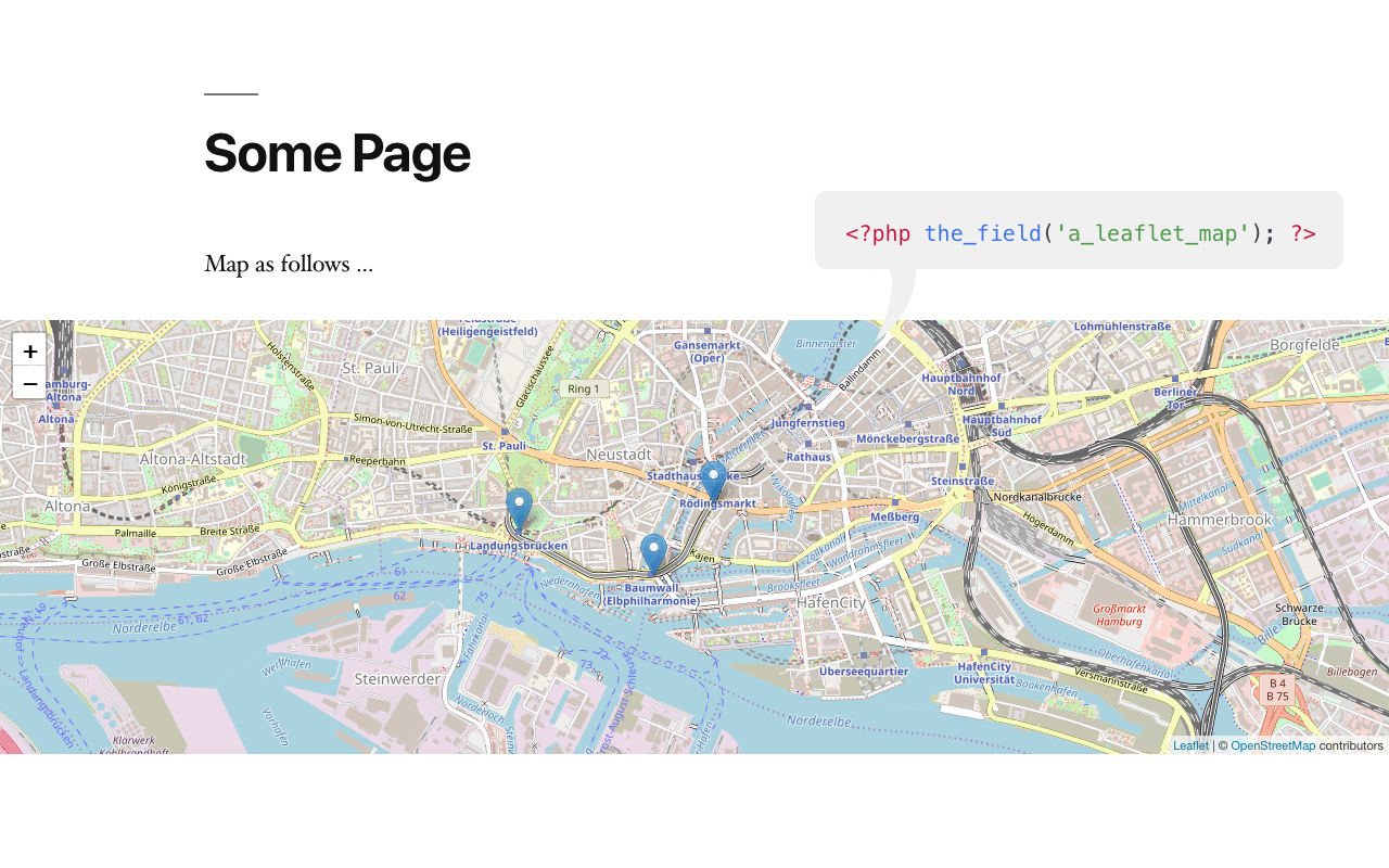
Display in the Frontend
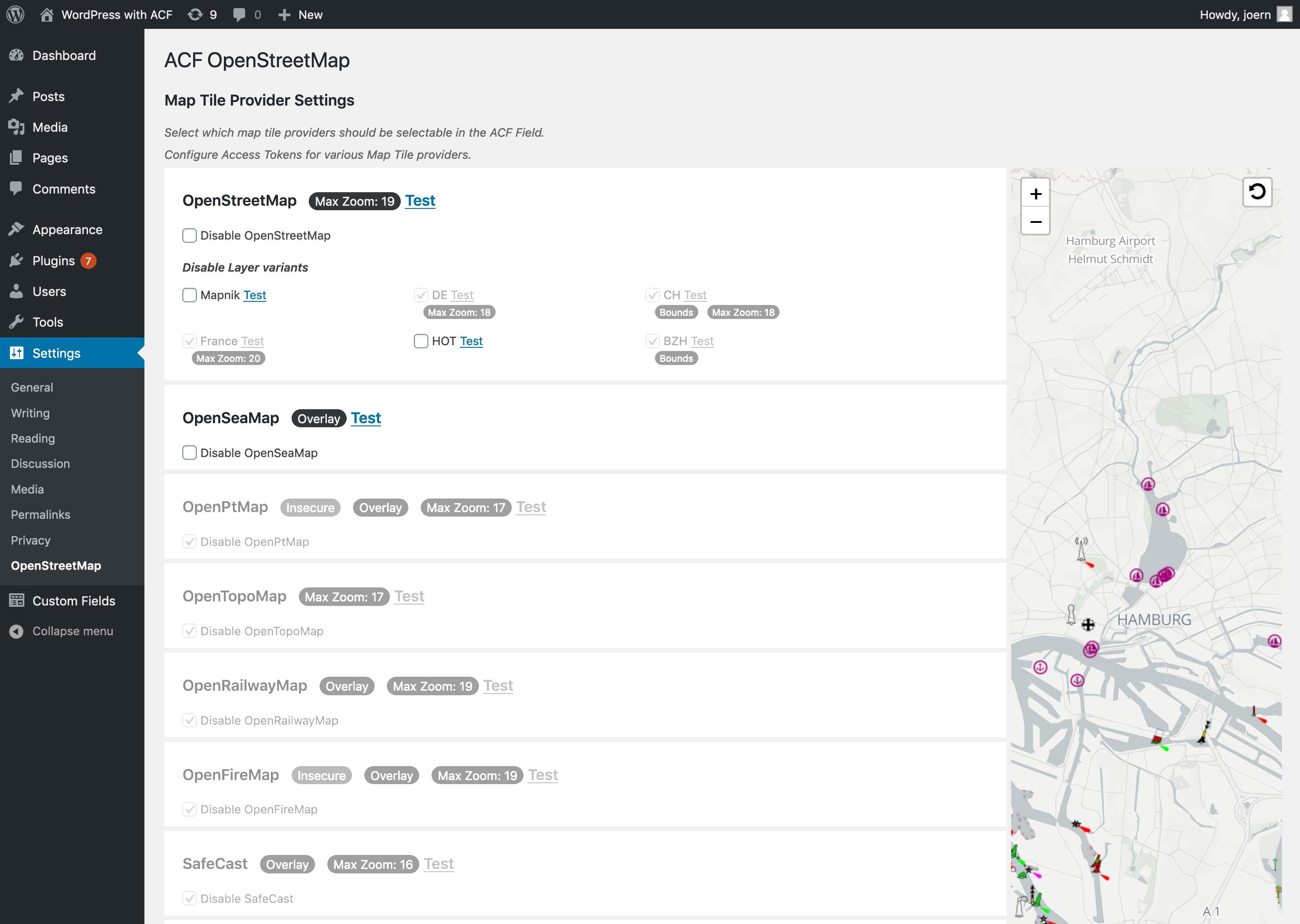
Settings page. Configure API access keys and disable specific tile layers.