Embed Webmap Wordpress Plugin - Rating, Reviews, Demo & Download

Plugin Description
Easily and quickly embed ArcGIS Online Webmaps into WordPress!
Usage
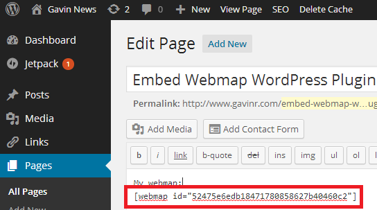
Get your webmap ID (see screenshots for help) of a public webmap in ArcGIS Online, then in any page or post in WordPress include this shortcode:
[webmap id="52475e6edb18471780858627b40460c2"]
… replacing the ID section with the webmap ID that you got from your map.
You can add many different options to the shortcode. See “Other Notes” above for details.
Shortcode Options
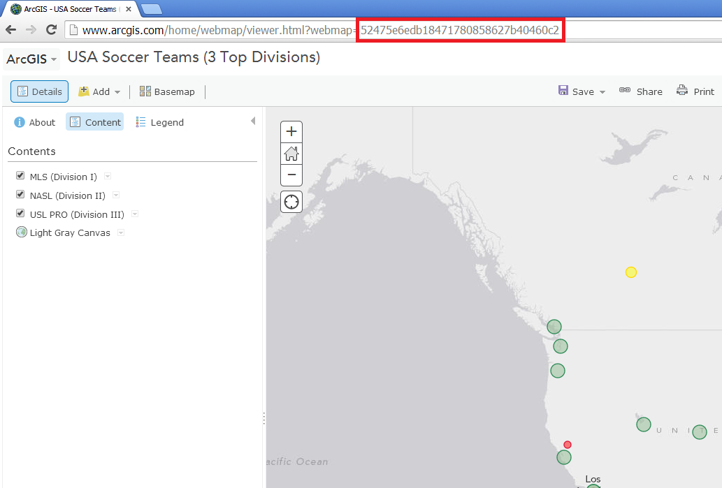
- id – The webmap ID of the map you wish to embed. Get this from the URL bar on arcgis.com. See the “Screenshots” page for help. Example: [webmap id=”52475e6edb18471780858627b40460c2″]
- extent – in the “shortened” form. Use http://psstl.esri.com/apps/extenthelper/ for help. Example: [webmap extent=”-159.3635,7.093,-45.8967,63.7401″]
- height – specify the height, in pixels. Example: [webmap height=”600″]
- width – specify the width, in pixels. Example: [webmap width=”230″]
- zoom – Include zoom buttons. Example: [webmap id=”52475e6edb18471780858627b40460c2″ zoom]
- home – Include a home button. If this is included, the zoom buttons will automatically be included. Example: [webmap id=”52475e6edb18471780858627b40460c2″ home]
- scale – Include a scale bar. Example: [webmap scale id=”52475e6edb18471780858627b40460c2″]
- legend – Include a legend button. Example: [webmap id=”52475e6edb18471780858627b40460c2″ legend]
- search – Include a location search textbox. Example: [webmap id=”52475e6edb18471780858627b40460c2″ search]
- searchextent – When using ‘search’ (above), only search the current extent. Example: [webmap id=”52475e6edb18471780858627b40460c2″ search searchextent]
- basemap_toggle – Show a basemap toggle. Must also include ‘alt_basemap’ to indicate alternate basemap that will show when the toggle button is clicked. Example: [webmap id=”52475e6edb18471780858627b40460c2″ basemap_toggle alt_basemap=”streets”]
- basemap_gallery – Include a basemap menu. [webmap id=”52475e6edb18471780858627b40460c2″ basemap_gallery]
- view-larger-link – Include a link below the map to view the map in a larger window. Example: [webmap id=”52475e6edb18471780858627b40460c2″ view-larger-link]
- disable_scroll – When the mouse is over the map, the scroll will not zoom the map if this is added. Example: [webmap id=”52475e6edb18471780858627b40460c2″ disable_scroll]
- details – Show the map details pane. Example: [webmap id=”52475e6edb18471780858627b40460c2″ details]
Depricated Options:
- description – DEPRICATED. PLEASE USE ‘DETAILS’ INSTEAD.
- basemaps – DEPRICATED. PLEASE USE BASEMAP_GALLERY INSTEAD.
Screenshots

Get webmap ID from Arcgis.com details page.

Or, get webmap ID from Arcgis.com map page.

Then, embed the ID in your WordPress page or post using the shortcode.

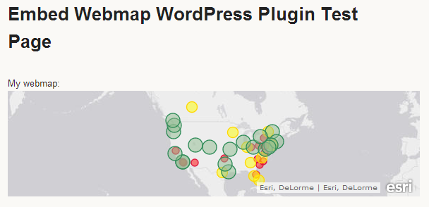
Your map appears!

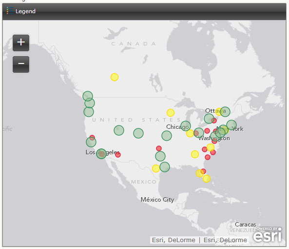
The shortcode has many options, including legend and zoom.


