
Municipal Boundaries Wordpress Plugin - Rating, Reviews, Demo & Download
Plugin Description
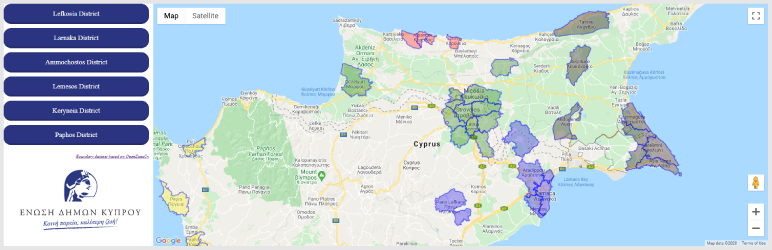
Municipal Boundaries is a simple plugin that renders current Cyprus Municipal Boundaries (as of 05/2020) on a Google Map. The dataset is provided AS-IS and is based on an optimised set of KML data from OpenDataCy. For more information about the data, please refer to their respective pages Provincial Administrative Boundaries and Map of the Borders of Local Authorities of the Republic of Cyprus at OpenDataCy.
Languages supported: Greek, English
Plugin requires a Google Maps Api key. In case Google Maps Api is already loaded into your theme or from another plugin, do not provide the Api key in Plugin Settings.
Once plugin is configured, you may place “[municipal-boundaries-map]” shortcode in your editor or file.
Screenshots

Basic demo UI.