
Treweler Map Builder Wordpress Plugin - Rating, Reviews, Demo & Download
Plugin Description
The Treweler plugin is a flexible and multifunction WordPress map builder based on the Mapbox web mapping platform. Its purpose is to help you create a custom map for your personal or business project. This combination of plugin functionality and Mapbox map customization provides limitless possibilities when creating a way to describe the world around us.
Treweler Free Features
These features are available in the free version of the plugin, which can be downloaded from this page. Upgrade to Treweler Pro to get access to all plugin features and premium support.
Map Features
- Fully integrated and compatible with WordPress and Mapbox platforms.
- Create and manage any number of maps in a few clicks.
- Display full-screen maps using any WordPress page.
- Publish your map in any place using shortcode functionality and settings.
- Great choice of pre-installed map styles.
- Ability to create your own style using Mapbox Design Studio.
- The initial geographical center and zoom level.
- Using the same map with different initial point and zoom settings.
- Setting the display of standard map controls such as Distance Scale, Fullscreen, Search, Zoom & Pan, Geocoder and Geolocation.
- Manage the display of the required Mapbox logo and text attribution.
- Сhanging the language of text labels on maps.
- The “Geolocation” control to manually obtain the user’s current location.
- Add a custom progress preloader with logo and text information that will appear once the entire map is loaded.
- Add title, description and logo to make your maps unique.
- Enable 3D terrain and 3D buildings for your Mapbox Studio style.
- 3D projection of the globe and 7 additional map rpojections.
Markers & Popups
- Add any number of markers to your maps.
- Ability to add a marker to multiple maps.
- Great choice of built-in marker styles with a wide range of settings.
- Enable marker popups and customize their styles and behavior.
- Customize the opening and visibility of marker popups.
- Google Material icons support.
- Center marker on a click.
Routes
- The ability to manage any number of routes and their styles.
- Draw a route using the draw tools and route match modes (driving, walking, cycling).
- Customize the following route line styles: color, width, opacity, dash and gap.
- Ability to add a route to multiple maps.
Treweler PRO
These features are only available with a Treweler Pro license. Upgrade to Pro version to get access to all plugin features and premium support.
Map Features
- Restrict the zoom range of the map.
- The initial pitch and bearing.
- Restrict map panning to coordinates or completely disable it.
- Displaying a single world or multiple copies of the world.
- Add a custom overlay color on the main map.
- The ability automatically display the user’s current location at the initial map loading.
- Place additional information or interesting facts on the map, using information widgets.
Markers & Popups
- Enable marker clusters to display a large number of markers on your map.
- Activate the lightbox photo galleries to describe marked places in more detail.
- Upload your own images in any graphic format as custom markers.
- Marker templates builder.
- Custom fields builder.
- Customize marker text labels for clearer navigation.
- Group markers together using categories and related functionality.
Interactive Tours
- Ability to switch between markers and areas.
- Two animation options: Jump or Fly.
- Control the flight speed, flight curve and zoom level.
- Enable or disable the display of popups when focusing on a marker during the tour.
- Four possible tour controls positions.
- Control markers offset by choosing any of the four possible directions.
Routes
- Import a route in GPX file format.
- Group routes together using categories and related functionality.
Countries & Regions Boundaries
- Build and customize any combination of countries or regions.
- Countries boundaries presets (Entire World, by Continents, by United Nations regions, by World Bank Regions, by Subregions, and any custom combination).
- Admin 1 and admin 2 regions boundaries for the following countries: Australia, Canada, France, Germany, Italy, Spain, United Kingdom, USA.
- Polygon fill color and opacity settings (initial state, hover state, selected state, custom state).
- Polygon stroke color and opacity settings.
- Action on click settings (none, open link).
- Hover settings (none, popup with region name, popup with region name and custom value).
Store Locator
- Display map markers within the user’s vicinity.
- Display map markers in the vicinity of the area on the map that the user chooses.
- Determined user’s position automatically, set manually by clicking on the map, or by using an intuitive address search with auto-completion.
- Custom styles for the geolocation marker.
- Option to show only necessary controls on the map (address search, automatic geolocation icon, sort by distance).
- Option to place controls in a preferred corner of the map.
- Sorting locations by distance.
- Custom values for sorting by distance.
- Setting default value for sorting by distance.
- Setting distance sorting in either kilometers or miles.
- Intuitive address search with auto-completion.
Shapes & Drawing Tools
- Add any number of shapes to your maps.
- Add a shape to multiple maps.
- Add lines by using the Line tool.
- Add other varieties of shapes using the Polygon tool.
- Add circles with the Circle tool.
- Use the Bezier tool to draw and edit bezier curves.
- Customize shapes by the following list of style settings: fill color and opacity, stroke color and opacity, stroke width, dash and gap.
Marker Templates Builder
- Making a large number of markers in the same style by creating a marker template.
- Marker style templates.
- Marker popup and image gallery templates.
- Marker text label templates.
- Marker custom fields templates.
- Change any marker setting while keeping the rest of the template settings.
Custom Fields Builder
- Expand your marker popup information with custom fields builder.
- Create any number of custom fields.
- Use the following types of custom fields: text, link, email, phone, and separator.
- Edit custom fields text information, and change their style and order.
- Default and custom values.
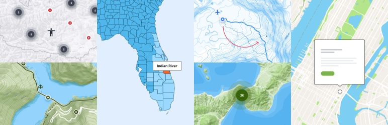
Screenshots

Piva Lake Interactive Guide.

Treweler Pro. Everest South Col Route.

General map settings.

Marker style settings.

Marker ballon style settings.

Marker popup settings.

Route drawing modes and style settings.

Additional CSS settings.

Treweler Pro. United States Counties Interactive Boundaries.

The Largest Cities In Italy.

Treweler Pro. Austria Store Locator.

Treweler Pro. Utah County Households Interactive Boundaries.

Disentis Village Map.

Treweler Pro. New York Interactive Tour.

Treweler Pro. USA States Population Interactive Boundaries.